
Valleys and mountains
Look at Romagna from above and you will see a comb: from the ridge of the Apennines many long, narrow valleys run down towards the sea, side by side, separated by thin ridges. Here are their names, from south to north, the mountains they start from and what makes each one special.


Why the valleys lie side by side
The pattern is always the same, from Montefeltro to Bologna. This is how it works.
A comb of valleys
The ridge of the Apennines runs from north-west to south-east, along the border with Tuscany. The rivers all run straight down to the north-east, towards the plain and the sea, and each one carves its own valley: this is why they are parallel like the teeth of a comb.
Narrow at the top, wide at the bottom
Up high the valleys are narrow gorges among beech and chestnut woods, with villages down by the river. Halfway they widen among gypsum, badlands and vineyards. Where they open onto the plain they meet the Via Emilia and a city: Rimini, Cesena, Forlì, Faenza, Imola, Bologna.
Where the rivers go
From the Conca to the Lamone the rivers reach the Adriatic on their own. From the Senio towards Bologna, instead, they all flow into the Reno, which takes them to the sea at Casal Borsetti, north of Ravenna.
Tuscany up top, but Romagnol is spoken
The heads of many valleys are the "Tuscan Romagna". Until 1923 Bagno di Romagna, Santa Sofia, Premilcuore, Portico, Rocca San Casciano, Modigliana and Tredozio were in the province of Florence. Marradi, Palazzuolo sul Senio and Firenzuola still are today, yet in dialect and cooking they are Romagnol.
The peaks the valleys start from
The main mountains from south to north, from Montefeltro to the Bologna Apennines.
 Photo: Toni Pecoraro, pubblico dominio, Wikimedia Commons
Monte Carpegna
1.415 m
The roof of Montefeltro: a limestone massif with white rocks, between the Marche, Romagna and Tuscany. The Conca rises on its slopes. The climb to the Cippo di Carpegna was Marco Pantani's favourite.
 Photo: Paolo Perticara, CC BY-SA 4.0, Wikimedia Commons
Sasso Simone e Simoncello
Two table-shaped mountains with flat tops, in the park named after them. In the 16th century the Medici built a small fortified town on Sasso Simone, now vanished.
 Photo: Boschetti marco 65, CC BY-SA 4.0, Wikimedia Commons
Monte Fumaiolo
1.407 m
Two rivers flowing into different seas rise on this mountain: the Savio towards the Adriatic and the Tiber, at 1,268 metres, towards Rome and the Tyrrhenian. In 1923 the border was moved so that the source of the Tiber would be in Romagna.
 Photo: Elwhajeff, CC BY-SA 3.0, Wikimedia Commons
Monte Falco
1.658 m
The highest peak of Romagna, in the Casentinesi Forests National Park. From the top, among the beech woods, you see both the Tuscan Casentino and the valleys of Romagna; the Rabbi rises on its slopes.
 Photo: Marcogligio, CC BY-SA 4.0, Wikimedia Commons
Monte Falterona
1.654 m
Second by just a few metres, next to Monte Falco. On its Tuscan side, at 1,358 metres, is Capo d'Arno, the source of the river of Florence.
 Photo: Adriano Petrachi, pubblico dominio, Wikimedia Commons
Corno alle Scale
1.945 m
The highest peak of the Bologna area, with ski slopes and a regional park. A curiosity: its waters do not flow into the Reno but into the Panaro, towards Modena, and on the other side into the Tyrrhenian.
The valleys, from south to north
From Montefeltro to the hills of Bologna, in the order you meet them. The number helps you find them on the map.
 Photo: Diego Baglieri, CC BY-SA 4.0, Wikimedia Commons
1
The Conca valley
Conca · from Monte Carpegna to Cattolica, Misano Adriatico · 47 km
The Conca rises on Monte Carpegna at over 1,300 metres and in 47 almost straight kilometres reaches the sea between Cattolica and Misano. It is the southernmost valley of Romagna, short and gentle, crowned by Malatesta fortresses such as Montefiore and Gemmano. Near the mouth a dam built in 1978 forms the Conca reservoir, now a river park.
 Photo: Bruno Rijsman, CC BY-SA 2.0, Wikimedia Commons
2
The Marecchia valley
Marecchia · from Alpe della Luna to Rimini · 70 km
The heart of Montefeltro. The Marecchia rises in Tuscany on the Alpe della Luna and after 70 km reaches Rimini, which takes its name from the river. It has a very wide gravel bed and, on either side, lone rock spurs rising out of the clay: San Leo, Maioletto, Pennabilli and Verucchio stand on top of them. San Marino looks down on the valley from Monte Titano. Seven towns of the upper valley moved from the Marche to Emilia-Romagna in 2009.
 Photo: Marco Musmeci, CC BY-SA 4.0, Wikimedia Commons
3
The Uso and Rubicone valleys
Uso, Rubicone · from Perticara to Bellaria-Igea Marina · 49 km
Short valleys, all hills, between Rimini and Cesena. The Uso rises in Perticara, the old sulphur mining village, and after 49 km reaches the sea at Bellaria-Igea Marina. Next to it flows the Rubicone of Savignano, identified with the river Julius Caesar crossed in 49 BC saying "the die is cast". On the hills, Sogliano is famous for its pit-aged cheese, formaggio di fossa.
 Photo: Freirossi, CC BY-SA 4.0, Wikimedia Commons
4
The Savio valley
Savio · from Monte Fumaiolo to Lido di Savio · 96 km
The Savio rises on Monte Fumaiolo, the same mountain as the Tiber, and after 96 km reaches the sea between Lido di Savio and Lido di Classe. It is the "through" valley of Romagna: the E45 climbs all of it and crosses the Apennines towards Arezzo and Umbria. Along the way you find the spa of Bagno di Romagna, Sarsina, birthplace of the playwright Plautus, the lake of Quarto and Cesena, where the valley opens onto the plain.
 Photo: Marino Alessandrini, CC BY-SA 4.0, Wikimedia Commons
5
The Bidente valley
Bidente, Ronco · from Foreste Casentinesi to Ravenna, Fiumi Uniti · 82 km
The Bidente rises in the Casentinesi Forests from three branches (Corniolo, Ridracoli and Pietrapazza) that meet near Santa Sofia. On the Ridracoli branch stands the 1982 dam, 103 metres high: its lake supplies drinking water to almost all of Romagna. After Meldola, at the Ponte dei Veneziani, the river changes its name to Ronco; near Ravenna it joins the Montone and together they reach the sea as the Fiumi Uniti.
 Photo: Perkele at Italian Wikipedia, pubblico dominio, Wikimedia Commons
6
The Rabbi valley
Rabbi · from Monte Falco to Forlì · 63 km
The Rabbi rises at 1,200 metres on the slopes of Monte Falco, the highest peak of Romagna, and after 63 km flows into the Montone on the edge of Forlì. It is a narrow, wild valley cut into sandstone, with the clear river pools of Premilcuore. Lower down it passes Predappio, Mussolini's birthplace, and its fortress.
 Photo: Pederzoli Valter, CC BY 3.0, Wikimedia Commons
7
The Montone valley
Montone · from San Benedetto in Alpe to Ravenna, Fiumi Uniti
The Montone begins at San Benedetto in Alpe, where three streams meet: one is the Acquacheta, the waterfall Dante recalls in Canto XVI of the Inferno. The valley is the historic road between Forlì and Florence: the Tosco-Romagnola road climbs it up to the Muraglione pass. Portico, Rocca San Casciano, Dovadola and Castrocaro, with its spa and fortress, are the towns along the river, which after Forlì reaches Ravenna and the sea together with the Ronco.
 Photo: Gianni Careddu, CC BY-SA 4.0, Wikimedia Commons
8
The Tramazzo and Marzeno valleys
Tramazzo, Marzeno · from Monte Collina to Faenza
Two small side valleys between Forlì and Faenza. The Tramazzo rises on Monte Collina, passes Tredozio and in Modigliana joins the Acerreta and the Ibola stream: from there on it is called the Marzeno and flows into the Lamone at Faenza. Modigliana is watched over by the ruins of the Roccaccia of the Counts Guidi; around it, hills of chestnut trees and Sangiovese vineyards.
 Photo: Federiscio, CC BY-SA 4.0, Wikimedia Commons
9
The Lamone valley
Lamone · from Colla di Casaglia to Marina Romea · 97 km
The Lamone rises in Tuscany at the Colla di Casaglia, passes Marradi, home of the poet Dino Campana, then Brisighella and Faenza, and after 97 km reaches the sea at Marina Romea. The Faentina railway climbs the whole valley to Florence. At Brisighella the valley cuts through the Vena del Gesso: the three hills of the town, with the Rocca, the Clock Tower and the Monticino sanctuary, are made of gypsum. Around them, badlands and the olive groves of Brisighella oil.
 Photo: Vanni Lazzari, CC BY-SA 4.0, Wikimedia Commons
10
The Senio valley
Senio · from Monte Carzolano to Reno · 88 km
The Senio rises below Monte Carzolano, in Tuscany, comes down through Palazzuolo sul Senio and Casola Valsenio, with its Herb Garden, then Riolo Terme and Castel Bolognese, and after 88 km flows into the Reno. Between Riolo and Casola the valley cuts through the Vena del Gesso, below Monte Mauro. In the winter of 1944-45 the war front stood still for months right along this river.
 Photo: Lorenzo Gaudenzi, CC BY-SA 4.0, Wikimedia Commons
11
The Santerno valley
Santerno · from Passo della Futa to Reno
The Santerno rises near the Futa pass and its first 27 km are in Tuscany, in the basin of Firenzuola, the land of pietra serena sandstone. Then it comes down through Castel del Rio, with the humpbacked Alidosi bridge, Fontanelice and Borgo Tossignano, where it crosses the Vena del Gesso, to Imola. It is the largest tributary of the Reno, in length and in water.
 Photo: Carlo Pelagalli, CC BY-SA 3.0, Wikimedia Commons
12
The Sillaro valley
Sillaro · from Monte Tre Poggioli to Reno
The Sillaro rises at the foot of Monte Tre Poggioli, enters Emilia-Romagna at Giugnola and runs down among the badlands to Castel San Pietro Terme and the Reno. It is the traditional border between Romagna and Emilia: east of it people speak Romagnol, west of it already Bolognese. A quiet valley of fields, villages such as Sassoleone and grey clay.
 Photo: Patafisik, CC BY-SA 4.0, Wikimedia Commons
13
The Idice and Zena valleys
Idice · from Passo della Raticosa to Reno · 78 km
The Idice rises in Tuscany below the Raticosa pass and after 78 km reaches the Reno. It passes Monghidoro and Monterenzio, where a settlement and a cemetery of Etruscans and Celts were found on Monte Bibele, then San Lazzaro di Savena and the Bologna Gypsum Park, with its caves in the gypsum. Its basin is the largest among the Reno tributaries, but in summer the upper stretch is almost dry.
 Photo: Mauman85, CC BY-SA 4.0, Wikimedia Commons
14
The Savena valley
Savena · from Passo della Futa to Idice
The Savena rises from an amphitheatre of mountains just below the Futa pass and comes down towards Bologna between Loiano and Pianoro, then flows into the Idice, to which in summer it brings almost all the water. The Futa road climbs from this side towards Tuscany. For centuries a canal carried its water right into the city of Bologna.
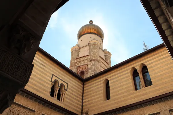 Photo: Sailko, CC BY 3.0, Wikimedia Commons
15
The Reno and Setta valleys
Reno, Setta · from Prunetta to Casal Borsetti · 211 km
The Reno rises in Tuscany, at Prunetta, and at 211 km it is the longest river of Emilia-Romagna after the Po. It comes down through Porretta Terme, Vergato and Marzabotto, home of the Etruscan city of Kainua, to Sasso Marconi, where the Setta joins it, and Casalecchio. The Setta valley carries the A1 motorway and the railway to Florence. On the plain the Reno gathers almost all the rivers from the Samoggia to the Senio and reaches the sea at Casal Borsetti.
 Photo: Après-Midyuzzo, CC BY-SA 4.0, Wikimedia Commons
16
The Samoggia and Lavino valleys
Samoggia, Lavino · from Castel d'Aiano to Reno · 60 km
Here the comb closes, towards Modena. The Samoggia rises at about 800 metres in Castel d'Aiano and after 60 km flows into the Reno; next to it runs the Lavino of Monte San Pietro. These are gentle hills, with castles such as the fortress of Bazzano and the Pignoletto vineyards of the Colli Bolognesi.
The rocks that make the landscape
Going up a valley you cross different rocks, and each one draws a landscape of its own.
Layered sandstone, up high
The high Apennines of Romagna are made of layers of sandstone and marl stacked like the pages of a book: you see them in the river beds and in waterfalls such as the Acquacheta. On top grow the great beech forests of the Casentinesi Forests.
Lone crags, in Montefeltro
In the Marecchia valley and around Carpegna, masses of limestone and sandstone that arrived from far away millions of years ago rest on top of clay. The clay wears away, the rock stays: this is how the crags of San Leo, San Marino and Sasso Simone and Simoncello were born.
The Vena del Gesso, halfway down
A wall of gypsum about 25 km long and a kilometre and a half wide cuts across the Santerno, Senio, Sintria and Lamone valleys. It shines in the sun and is full of caves and sinkholes. Since 2023 it has been a UNESCO World Heritage site together with the Bologna gypsum.
The badlands, towards the plain
Lower down lie the grey clays of an ancient sea. The rain carves them into bare ridges and gullies, the calanchi: you see them at Brisighella, along the Sillaro and the Idice. They are beautiful but fragile: with the flood of May 2023 the hills of Romagna had thousands of landslides.

Visiting the valleys: three tips
Go from one valley to the next via the bottom
Along a valley you travel fast, but to reach the next one you have to cross a ridge on narrow, winding roads. It is often better to drive down to the Via Emilia and up the next valley: more kilometres, less time.
Each valley has its own pass to Tuscany
The E45 climbs the Savio valley, the Tosco-Romagnola road the Montone up to the Muraglione, the Marradi road the Lamone up to the Colla di Casaglia, the Montanara the Santerno, the Futa road runs between the Savena and the Idice, the Porrettana up the Reno and the A1 motorway up the Setta.
After the rain, check the road
The valleys are largely made of clay and marl, which can slide after days of rain. Before driving up into the mountains in winter or after a storm, check that the road is open.
Facts checked on 19 October 2026 on the Wikipedia articles of each river and mountain and of the Vena del Gesso Romagnola Park. Photos and map from Wikimedia Commons, with author and licence.
Want to go up the valleys without driving?
Bends, passes and mountain roads: leave the wheel to a driver who knows them, from the coast or the airport to the village you want to see.